Thursday, March 13, 2008

NERBAC-Cebu One-Stop Business Registering and Licensing

Link

We're aggressively promoting the services of NERBAC-Cebu. Cebu NERBAC is being made as a pilot project by the government for fast business registering and licensing.

Created through the Republic Act 7470, NERBAC is an all-in-one center that houses all concerned agencies in the government. It processes all regulatory requirements in starting a business and provides investments information on Central Visayas.

I hope businessmen will support this government move and have their businesses registered at the NERBAC-Cebu to reduce graft and corruption.

Thursday, October 19, 2006

Lanao del Sur

Overview
Lanao del Sur is the land of the Maranaos, “people of the lake,” among the most devout of Muslim tribes as well as the most artistic. Nowhere is this more evident than in the the people’s most natural way of life and the land’s most attractive sites.

The life of the Maranaos centers on Lake Lanao, the second largest and deepest in the Philippines and one of the most breathtakingly beautiful. The lake is surrounded with myths and legends.

The climate here is envigorating and fine grazing land stretches into the distance. A commanding view of the lake is offered by Marawi City, the provincial capital. The unique natural setting of the Maranaos is perhaps best manifested in Marawi Cty, by the presence of the many large torogans, the Maranao houses, which are characterized by an antique royal high roof with curved designs.

The city’s Aga Khan Museum, located within Mindanao State University, is a repository of Maranao and other Moro artifacts. It boasts a huge collection of indigenous art and cultural materials, ethnic music, the native tools and weapons used by the Muslims, and Muslim houses of different artistic designs.

Founded in 1962, the university draws the most crowds to the city. The Maranaos’ flair for the creative is exhibited by their numerous ceremonial artifacts and everyday tools trimmed with the sensuous "okir" (carving) and colorful "nagas" (serpent figures). Their long, low, and sleek boats sport a rainbow of brilliant colors matched only by the exuberance of the malong, the native wear of the Maranao women. Worn as a shirt or dress, used to cover the head or as a blanket, the highly decorated malong is violet, purple, green, red, yellow, floral, and geometric.

Geography
Lanao del Sur forms the western portion of Northern Mindanao. It is bounded on the north by Lanao del Norte, on the east by Bukidnon, on the west by Illana Bay, and on the south by Maguindanao and Cotabato. Rolling hills and valleys, a placid lake and river dominate the landscape.

Climate
The province has a cool and pleasant climate that falls dominantly under type F, which is distinguished by an even distribution of rainfall throughout the year. The Philippine summer is not quite distinct here. The wettest month is February and the dryest month is June. Lanao del Sur is outside of the typhoon belt

Language / Dialect
The Maranao dialect is the most commonly spoken. Also spoken are Tagalog and Visaya as well as English and Arabic.


Lanao Del Sur Is Famous For...

Aga Khan Museum
This repository of Maranao and other Moro artifacts boasts a huge collection of indigenous art and cultural materials, ethnic music, the native tools and weapons used by the Muslims, and houses of different artistic designs. It was named so in honor of King Aga Khan who contributed significantly to the realization of the museum. It is located within Mindanao State University, Marawi City.

Moncado Colony
It was named in honor of Hilario Camino Moncado, a native Filipino, a leader, an organizer, an author of books, and a lecturer on the humanities. He graduated with honors at the age of nine from the India College of Mystery and Psychics. Moncado monuments as well as monuments of wild animals can be found on the site. It is located in Moncado, Cadingilan.

Torogans & Sambitory Old Building
The unique natural setting of the Maranaos in Marawi City is best manifested by the presence of the many large torogans, the Maranao houses, characterized by an antique royal high roof with curved designs. The torogans are found in Amito, Dayawan, Marawi City, Sambitory Building, Barrio Naga, Marawi City.

Lake Lanao
Lake Lanao is the second largest and deepest in the Philippines, at 2,300 feet above sea level. Marawi City, the provincial capital, lies in a rolling terrain commanding a majestic view of the fascinating Lake Lanao.

Bagang Beach
The beach is filled with rocks and boulders that serve as benches, and trees in the lakeside that provide shade. It is ideal for picnics, and its clear water makes it a good place for boating and swimming. Bagang Beach is located in Caloocan, Marawi City, two meters away from the commercial site of the city.

Agus River
Agus River is said to be the swiftest running in the country. Its famous cataract is the Maria Cristina Falls, an outlet of Lake Lanao to Illana Bay. It is located in between Saduc and Lilod, Marawi City.

Kilometer Zero Point Marker
It is an important landmark in Lanao del Sur, from which all distances in Mindanao are measured. This is similar to the measures of distances in Manila, which begin at the Rizal Monument in Rizal Park.

Mindanao State University (MSU)
Marawi City draws the most number of visitors within Lanao del Sur due in most part to MSU. Founded in 1962, it serves as an educational institute and a center of social and cultural integration.

Dasalan Handicraft Building
It houses Maranao art-in-execution. Expert carvers and weavers offer live demonstrations here, displaying their impressive craft and skills.

Tugaya Town
It has a near-exclusive reputation for producing brassware, being the only community in the province that produces excellent brassware. Practically every family has a bellows in the area where the metals are smelted. Using the cire perdule or lost wax technique, cannons and gongs, betelnut boxes and rice pots are made. (wowphilippines)

Tuesday, October 17, 2006

Lanao del Norte

Overview
The Provincial Government of Lanao del Norte, “Land of Beauty and Bounty,” has been exerting its best effort to uplift the quality of life of the people in the rural and urban areas in the province through the promotion of Integrated Agriculture and Economics Tourism Development Programs.

The primary goal of the development plans is to create conditions that will facilitate and accelerate economic word of the province. One of the conditions identified is to promote the tourism industry that would act as a catalyst for the development of trade and other economic interactions between outlying municipalities in the province and its neighboring provinces as well.

Geography
The province of Lanao del Norte is located in the Northern Mindanao Area along the North western Coast. Three known fishing grounds bound ten of its 22 Municipalities, namely: Iligan Bay, Panguil Bay, and Illana Bay.

The province is bounded by the provinces of Maguindanao and Cotabato on the North, South Cotabato on the South; Davao del Sur on the East and Celebes Sea on the west.
Land Area: 355,636 sq. kms.

Topography
The province is traversed by several rivers, the most important of which is the Agus River which feeds the Ma. Cristina Falls, a major source of hydroelectric power for the Mindanao Grid.
Generally ranges are plain and surrounded by high mountain ranges from all directions.

Political Subdivisions
The province is comprised of 22 municipalities, namely: Bacolod, Balo-i, Baroy, Kapatagan, Kauswagan, Lala, Linamon, Magsaysay, Maigo, Matungao, Munai, Nunungan, Pantao Ragat, Pantar, Poona Piagapo, Salvador, Sapad, Sultan Naga Dimaporo (Karomatan), Tagoloan, Tangkal, and Tubod. It has 462 barangays. The municipality of Tubod is the capital town of the province. It has 2 Districts, (1st) Iligan City to the Municipality of Baroy and (2nd ) from Municipality of Balo-I to Sapad.

Population
Has a population of 387,324 with a population density of 109.00 per square kilometers.

Language / Dialect
The Christian-Muslim ratio is 60:40 in favor of the Christians. Cebuano, English & Filipino are widely spoken among Christians, and Maranao for Muslim.

Climate
Lanao del Norte is outside the typhoon belt and has a non-seasonal climate with an average yearly rainfall of 60 inches. The average temperature is 80 degrees on the Fahrenheit scale.

Industries
Rice, corn, coconut, marine products (crabs, shrimps, sea shells, sea woods), and wood products.


A. Products

· Seaweeds

B. Key players

· 1 association with 246 members

C. Market

· Domestic

D. Trade and investment opportunities

· Appropriate trainings and exposures
· Establish production support facilities
· Establish data bank system for easy access to information such as market trends (application of ICT)
· Establish mechanism for project monitoring
· Advocate, formulate and implement policies for seaweeds

History
The term Lanao is derived from the Maranao word “Ranao” meaning a body of water. “Maranao” means lake dweller. They are the natives of the place occupying the land around Lake Lanao, which is situated at the central part of Lanao del Sur. Lanao applied to the entire area before its division.

When it was divided into two provinces, the southern portion became Lanao del Sur and the northern part became Lanao del Norte.

The Maranaos are a tribe of Malay-Arabic descent. They settled in the area long before the advent of the Spaniards in the Philippines. They possess their own culture and civilization which makes them quite unique. Their language, customs, traditions, religion, social system, costumes, music, and other features are factors that make Lanao peculiar and distinct from other Philippine provinces. (maranao, wowphilippines & DTI)

Sunday, October 08, 2006

Zamboanga del Sur

Overview
The province of Zamboanga del Sur is bounded on the north by the province of Zamboanga del Norte; on the south by the Moro Gulf; on the southwest by Zamboanga Sibugay; and on the east and northeast by Lanao del Norte, Misamis Occidental, and Panguil Bay.

The original inhabitants of the Zamboanga peninsula were the Subanons, who settled along the riverbanks. The next group of settlers to arrive were Muslim migrants from the neighboring provinces.

The Maguindanaoans and Kalibugans were farmers; the Tausugs, Samals, and Badjaos were fishermen; and the Maranaos were traders and artisans. The Muslim settlers also looked on mat weaving as its major occupation.

Then came an exodus of migrants from nearby provinces. Historians say that majority of them came from the Visayas, Cebu, Bohol, Negros, and Siquijor.

Together with the original settlers, these pioneers helped develop Zamboanga del Sur into the abundant and culturally diverse province that it is.

Today the province comprises two congressional districts with 26 municipalities and one component city.

Pagadian City, its capital, with a total of 681 barangays, has been declared as the new regional seat of Region IX.

Geography
Zamboanga del Sur occupies the southern section of the Zamboanga peninsula that forms the western part of the Island of Mindanao. It is located within a longitude of 122º 30"" and latitude of 7º 15"" north. It has a total land area of 473, 491hectares or 4,734.91 sq. m.

Stretching northward from Sibugay in the southwest and running along the northern boundary to Salug Valley in the east is the province’s mountainous countryside.

The coastal plains are extending regularly from south to west then spreading into wide flat lands when reaching the coastal plains of the Baganian peninsula in the southeast.

Political Subdivision
Zamboanga del Sur consists of two congressional districts with 26 municipalities and one city, with a total of 681 barangays.

Language/ Dialect
The major dialect is Cebuano, spoken by 61.31% of the population. Also spoken are Tagalog, Subanon, Chavacano, Ilonggo, Maguindanao, Tausug, Boholano, and Ilocano.

Population
As of the year 2000 census, Zamboanga del Sur had reached a population of 836, 147.

Climate
The province has a relatively high mean annual rainfall that varies from 1,599 millimeters in drier areas to 3,500 millimeters in the wettest portion. Temperature is relatively warm and constant throughout the year ranging from the minimum temperature of 22 to 35 degrees Celsius.

Trade and Industry
Agri-based manufacture of coco oil, livestock feed milling, rice/ corn milling, including the processing of fruits; gifts and housewares made from indigenous materials like handmade paper, roots, rattan, buri, and bamboo; wood-based manufacture of furniture and furniture components from wood, rattan, and bamboo; marine and aquaculture including support services; construction services and manufacture of marble, concrete, and wooden construction materials.

A. Products

· Seaweeds

B. Key players

· All the 342 members of the Federated Barangay Seaweed Planters Assocition (FEBASPA)

C. Market

· Domestic

D. Investment opportunities

· Access to financial assistance for working capital, nursery and postharvest facilities
· New markets for new applications
· Strong support and priority focus on the industry from LGU and Las i.e., organized seaweed task force
· Easy access to markets
(wowphilippines & DTI)

Thursday, October 05, 2006

Butuan

Widely recognized as the earliest known place of settlement and sea trade in the Philippines, Butuan was already a commercial center of the country in early 10th century. The people from Butuan have already established trading relations with the kingdom of Champa which is now South Vietnam.

By the 11th century, Butuan was the center of trade and commerce in what will be know as the Philippines. The best evidence to prove this fact is the discovery of 9 balanghays and other archaeological finds in the vicinities of Butuan City, particularly in Ambangan, Libertad near the old El Rjo de Butuan and Masao River.

The city is located at the northeastern part of Agusan Valley in northern Mindanao, sprawling across the Agusan River. It is bounded to the north, west and south by Agusan del Norte, to the east by Agusan del Sur and to the northwest by Butuan Bay.

Land Area 758 sq km
Population 267,279 (2000 census)
Distance from Manila 491 miles south
Dialects Spoken Butuanon, Others Include Cebuano, Ilocano, Hiligaynon, Majority can speak and understand Tagalog and English

Background
Butuan, chartered city, southern Philippines, capital of Agusan del Norte Province, near the mouth of the Agusan River, on the northern coast of Mindanao. The city is a trade center for the Agusan river valley, where lumber, gold, abaca, and copra are produced.

Butuan is reputed to be the site at which the Portuguese navigator Ferdinand Magellan proclaimed Spanish sovereignty over the Philippine Archipelago in 1521. Population (1999 estimate) 247,074.

A description of Butuan is not complete without infusing it with the significance of the Agusan River and its tributaries that provide the valley with rich soil from periodic floods. Its serpentine route through the city and the two Agusan provinces provide the people with easy means of transportation for trade and commerce and encourage settlement along its banks. The Agusan River greatly helped the booming of the "Logging Industry" which earned Butuan the name " Timber City of the South".
Butuan sprawls across the Agusan River nine kilometers from its mouth. Towards this, to the north and seaward, run fertile rice lands.

Halfway round the city to the southwest, roll the gently sloping hills over there Mount Mayapay looms. To the east, the majestic Hilong-hilong and Diwata mountain ranges protect the entire valley from fierce Pacific storms. Its very difficult to pinpoint the exact time when the name Butuan first emerged.

People and Culture
Butuan, the prehistoric city by the river, is reportedly the site of the oldest settlement in the Philippines, and where the first catholic mass is said to have taken place.

The Butuanons are warm and kind-hearted, just like its name, Butuan, from the word "But-an" meaning "good".

Area Profile
Butuan, the provincial capital, is located at the central part of Agusan del Norte province. It lies flat along the banks of Agusan River following along course within the province of Davao del Norte, Agusan del Sur, Agusan del Norte and drains into Butuan Bay.

Butuan serves a strategic center of the Northern Mindanao region. The national highways from Misamis Oriental, Surigao and Davao traverse the city and meet at the junction of Barangay Ampayon, effectively linking the Northern Mindanao provinces together.

Commerce and Industry
Butuan, like the Caraga Provinces, is primarily an agricultural province. It is also one of the leading rice producer after Bukidnon. Butuan is also a major timber producer in the region.

There are 23 lumber producers and plywood plants in the city. Butuan's rattan is one of the best in the country. Other products include corn, vegetable, coconuts and bananas.

Amenities
Butuan has hotels with convention facilities which can accommodate 500 people and can provide audio-visual equipment upon request. Butuan caters to every filipino taste.

There are a lot of inexpensive restaurants that serve both local and international dishes. One can enjoy the most tasty dishes with the abundant supply of seafood, pao ( the native rootcrop), kayam, and onao from the sorroundings.

How to get There
By Air, Butuan is, 1 hour and 30 minutes away by plane from the national capital, Manila and 50 minutes from Cebu City. Philippine Airlines flies from Manila three times a week (Monday, Wednesday & Friday) for Cagayan de Oro and Cebu flies daily.

By Boat,Butuan is easily accessible by boat from Manila, Cebu and Bohol. Gothong Lines sails from Cebu to Butuan every Tuesday. By Land,Buses leave from capital cities of Mindanao to Butuan several times a day.

History
The name "Butuan" is believed to have originated from the sour fruit "Batuan". Other etymology sources say that it comes from a certain "Datu Buntuan", a chieftain who once ruled over Butuan.

As early as the 10th century, people from Butuan had already established trading relations with the Kingdom of Champa (now southern Vietnam).

By the 11th century, Butuan was the center of trade and commerce in the Philippines. The evidence to prove this fact is the discovery of 9 balangays (the Butuan Boat) and other archeological find in the vicinities of Butuan City, particularly in Ambangan, Libertad near the old El Rio de Butuan and Masao River.

Much controversy and debate have been generated with regard to the holding of the first mass. Whether it was held in Limasawa, Leyte or in Masao, Butuan City. It is sure, however, that Ferdinand Magellan did drop anchor by the mouth of Agusan River in 1521 and held mass to commemorate the event.

The first municipal election in Butuan took place on March 1902 in accordance with Public Law No. 82 which coincided with the American occupation of the place.

During the Japanese occupation of the Philippines in World War II, Butuan was razed to the ground when the guerilla forces attacked the enemy garrison during the middle of 1943.

On October 20, 1948, still recovering from the war, the entire municipality was ruined by a fire.

The boom of the logging industry during the 1950s up the middle of 1970s has made Butuan the "Timber City of the South". The outcome of which was the influx of business and fortune seekers from other provinces.

The once lethargic town suddenly became a bustling locality. The flourishing logging industry inspired and prompted Congressman Marcos M. Calo to file a bill converting Butuan into a city. On August 2, 1950, Butuan became a city by virtue of Republic Act No. 523 otherwise known as the City Charter of Butuan.

From being a chartered City, Butuan was reclassified into a highly urbanized city on February 7, 1985 pursuant to the provision of section 166 and 168 of Local Government code of 1997 and Memorandum circular 83-49 of the ministry of local Government.

The re-classification was based on its outcome and population as certified by the ministry of finance and national census and statistics office.(LGU)

Tuesday, October 03, 2006

Siargao


Siargao, in Surigao del Norte province, is home to Cloud 9, the best known surfing break in the Philippines. It has the reputation of being one of the top Surfing Waves in the world.

The tear-drop shaped island is situated 800 kilometers southeast of Manila. It has a land mass of approximately 437 kilometers. The east coast is relatively straight with one deep inlet -- Port Pilar with a coastline marked by a succession of reefs, small points and white sandy beaches.

The Island's Pacific-facing reefs are situated on the edge of the Philippine Trench, and the extremely deep offshore waters assure the ocean swells have undiluted power when they encounter the many coral and rock reefs, giving Siargao excellent surfing conditions, particularly during the southwest "habagat" monsoon from August to November, when the prevailing wind is offshore.

The best known surfing wave on Siargao with a worldwide reputation for thick, hollow tubes is "Cloud 9". This right-breaking reef wave is the site of the annual Siargao Cup, a domestic and international surfing competition sponsored by the provincial government of Surigao del Norte. The wave was discovered by traveling surfers in the late 1980's, and named and made famous by American photographer John S Callahan, who published the first major feature on Siargao Island in the US based SURFER Magazine in March 1993, and hundreds of photos in many other books and magazines since. Callahan has returned to the island many times since his first visit in 1992, and his efforts to photograph and publish surfing related and general location material from Siargao in books and magazines around the world has put the island on the international map and drawn thousands of surfers and tourists to Siargao.

There are several other quality waves on Siargao and nearby islands, but Cloud 9 has received more publicity than any other wave in the area, indeed in the Philippines as a whole. It is the only wave in the area accessible without a boat, leading to overcrowding and the nickname of "Crowd 9" among surfers worldwide as eager foreign and locally owned accommodation and tourist facilities attempt to profit from the magazine publicity and the annual influx of visitors drawn by the Siargao Cup competition in September.

While there are few rental craft on the island, Siargao has superb sea kayaking opportunities – on the east side, facing the Philippine Trench, the deep blue sea runs straight up against a perfect tropical coast, offering unparalleled wave-running.

On the other side of the island, one of the country’s largest expanses of virgin mangrove swamp provides an entirely different kind of exploration. This centuries-old ecosystem is a rich breeding ground for marine life, including the salt-water crocodile, and is an adventure no kayaker will want to miss.

Long stretches of wetlands likewise indicate potentials for commercial seaweed propagation. Siargao Island is greatly influenced by the winds and currents coming uninterrupted from the Pacific Ocean, intensified by the Mindanao current running westward through the Siargao Strait.

Offshore, a classic tropical island lay protected within its surrounding coral reef and the dozen coconut palms dressed in the center circle of the island rustled gently in the morning breeze. (wowphilippines)

Monday, October 02, 2006

Agusan del Norte

Overview
Agusan del Norte is the smallest province in the Caraga Region, classified as a second-class province. It is mountainous along its northeastern and western parts.

In between are flat, rolling lands, particularly where the Agusan River cuts through as it empties into Butuan Bay. The highest peak, Mt. Hilong-hilong, at 2,012 meters above sea level, is located in the Diwata Mountain Ranges near the eastern boundary of Surigao del Sur. Indigenous peoples of the Mamanwa, Manobo, and Higaonon/Tala-andig tribes populate its many mountains.

Geography
Located in the northeastern part of Mindanao, it is bounded on the north by Butuan Bay and Surigao del Norte; east by Surigao del Sur; west by Misamis Oriental; and south and southwest by Agusan del Sur. Agusan del Norte occupies a total land area of 2, 503.9 sq. kilometers.

Political Subdivision
Agusan del Norte is composed of 11 municipalities. Capital is Cabadbaran, which also serves as the administrative center. The commercial center is Butuan City.

Population
Agusan del Norte had a population of 299,313 as of 2003, growing at an annual rate of 1.89%.

Language/Dialect
Pilipino, English, Spanish, Fukienese, Cebuano, Butuanon, Ilonggo, Manobo, Mamanwa, Higa-onon, Maranao.

Climate
The province is located outside of the typhoon belt and has no definite dry season. Rainfall is pronounced throughout the year, occurring heavily from November to January.

Industries
Primarily an agricultural province, Agusan del Norte is the region’s leading rice producer. Other major products are coconut, corn, mango, bananas, palm oil, vegetables, and prawns.The province continues to be a major timber producer despite its extensive deforested areas. There are 23 lumber producers and plywood plants, most of them operating in Butuan City. Minor licensees concentrate on gathering rattan, considered the best in the country.The emerging industry mix is on agri-business, where its two special economic zones will play a vital role in transforming the place from a timber-dependent industry to a balanced agri-forestry-tourism industry.

Products

· Fresh cavendish bananas

Key players

· 2 people's organizations
· 2 investors

Market

· Domestic
· Export: Japan and China through local investor

Trade and investment opportunities

· Expansion of plantation/production area
· Increased production (wowphilippines & DTI)

Agusan del Sur

Overview
Located in Southern Philippines, Agusan del Sur is the fourth largest province in the country. It is endowed with rich natural resources contained in its vast agricultural, forest, and marsh lands. Its vision is to become an agro-processing center and an eco-tourism destination.

Agusan del Sur is a promising paradise found in the northeastern part of Mindanao. It is the land of the proud and brave Agusanons, a land of multi-ethnic and cultural diversity.

It is hidden in the vastness of 896,550 hectares of endless green carpets and undulating forest cover which envelope its half a million people with fresh mountain air. The long winding Agusan River passes through the middle valley of Agusan del Sur.

Geography
Agusan del Sur lies along the Maharlika Highway that links the three major island groups of the country. It has a land area of 896,550 hectares, with a flat and rolling topography suitable for agriculture, industry, and forestry.

It takes the shape of an elongated basin with mountain ranges in the eastern and western sides, which form a valley occupying the central longitudinal section of the land.

The Agusan River, which is among the many rivers that crisscross the province, cuts it into two along a north-south direction, fertilizing the land all year round. The southern part teems with swamps and lakes, forming one of the largest wetlands in Southern Asia.

Political Subdivision
Agusan del Sur occupies a portion of the Northern Mindanao Region bounded on the north by Agusan del Norte, on the east by Surigao del Sur, on the south by Davao del Norte, and on the west by Misamis Oriental and Bukidnon. The province has one congressional district, which is composed of 14 municipalities and 314 barangays. Its capital town is Prosperidad, also the seat of the provincial government.

Language/Dialect
Cebuano, Boholano, Ilonggo, English, Filipino, and Visayan.

Climate
The climate is pleasant, with no dry season but a very pronounced rainy period usually occuring in December to January. Monthly rainfall is 302 mm. while the average temperature is 27 degrees Celsius.

Industries
An industrial estate in Talacogon, the Agusan del Sur Provincial Industrial Center forms the nucleus of the Agusan del Sur growth diamond. It is expected to boost agro-industrial production and aid in the further growth of the economy. The Economic Zone will be hosting light to medium scale industries engaged mostly in agro-industrial processing.

Products

· Fresh fruit bunches (FFBs) for processing into crude palm oil and palm kernel
· Palm oil

Key players

· 1 processor
· 1 processor/large grower
· 2 large growers
· 1 farmers' group
· 64 individual growers

Market

· Domestic

Trade and investment opportunities

· Expansion of plantations/production areas due to large demand of FFBs from local processors (wowphilippines & DTI)

Friday, September 29, 2006

Compostela Valley

OVERVIEW
Compostela Valley is blessed with nature’s magnificent work of art. It brims with natural attractions like beaches, waterfalls, forests, mountain ranges, caves, lakes, rivers, hot and cold springs.The province is proud of its people and cultural heritage - a varied mixture of ethnicity and dominance.

To be in Compostela Valley is to experience a blend of sight and sound that defines a place and a people pulsing with life yet reserved in spirit.The provincial government believes in marketing tourism responsibly. ComValeños want to explore and revel on nature’s finest without destroying the environment.

Choices within the province are almost limitless. ComValeños believe that they have something that caters to everyone’s enthusiasm, all waiting for the adventurous spirit in you. They see their province as an eco-adventure tourism destination, and once experienced, so will you.

GEOGRAPHY
Compostela Valley is situated in Southeastern Mindanao. It has a total land area of 4,666.93 sq. km. and is bounded by Agusan del Sur on the north, Davao del Norte on the west, Davao Oriental on the east and southeast, and Davao Gulf on the west and southwest.

POLITICAL SUBDIVISION
Classified as a first class province, Compostela Valley is comprised of 11 municipalities grouped into two districts. District 1 consists of Monkayo, Montevista, Maragusan, New Bataan, and Compostela; and District 2, Laak, Mawab, Nabunturan, Maco, Mabini, and Pantukan. The municipality of Nabunturan was named capital town of the province.

POPULATION
The province’s population is estimated at 600,000 per 2000 National Census and Statistics Office survey.

LANGUAGE/DIALECT
Cebuano/Visayan, Tagalog/Pilipino, Mandaya, Mansaka, Hiligaynon, Ilocano, Waray, Maranao, and Suriganonon are the dialects spoken in the province.

CLIMATE
The province is generally tropical and with no marked rainy or dry season. Its mountain ranges and forest protect the area from visiting typhoons.

INDUSTRIES
Mining, banana, agro- industrial, fishing, farming, tourism.

HISTORY
The approval of Republic Act No. 8470 on January 30, 1998, which was ratified through a plebiscite held on March 7, 1998, marks the birth of Compostela Valley. This relatively new province was carved out of its mother province, Davao del Norte.

Compostela Valley is famous for the following:

Mountain Climbing/Trekking in Mt. Candalaga
Located in Maragusan, Mount Candalaga measures up to 7,880 feet above sea level. It has 30 waterfalls and 100 cold springs. It is home to the world’s largest flower, the Rafflesia. The mountain was the venue of the 1998 Mountaineeing Federation of the Philippines (MFPI) National Climb and Congress.

Mountain Climbing/Trekking in Mt. Manurigao
Located in New Bataan, Mount Manurigao measures 4,000 feet above sea level. It boasts of its majestic falls with 4 tiers and waterfalls at a height of 230 feet. One will spot the Philippine Eagle and wild deers.

Caving/Spelunking in Kumbilan Cave
Located in Nabunturan, Kumbilan Cave has tunnel-like features, wide chambers laden with beautiful formations. The presence of stalactites and stalagmites and other formations in one chamber of the cave responds to educational needs with regards to cave evaluation. Fauna observed as occupants of the cave are snakes and fruit flies. The cave serves as a lair to fruit bats locally known as “kabyaw.”

Aguacan Cold Spring Resort
Located in Maragusan, a kilometer away from the town’s centerpoint, is the Aguacan Cold Spring Resort. It has an olympic-size swimming pool, conference hall, restaurant, cottages for overnight stay, tent area, souvenir shop, billiard hall, table tennis, and volleyball court. It can house 100 guests and is ideal for conferences and meetings.

Mt. Diwalwal Gold Site
The gold mining site is located in Mt. Diwata at Monkayo. It is one of the biggest gold mining areas in the country.

Toyuzu Inland Resort
Located in Mainit, Nabunturan, the Toyuzu Inland Resort provides total relaxation facilities, such as swimming pools, a sauna bath, and a natural steam bath. Entrance fee is PhP35/pax. Cottages for day outings are available for PhP100; overnight stay for PhP750 (room good for 3 persons) and PhP1,500 (family room for 10 people).

Tagbibinta Falls
Located in Brgy. Coronobe, Maragusan, 5 km. from the town proper, is Tagbibinta Falls. It has a series of 7 falls, the first one measuring approximately 700 ft. in height. The falls provides an ideal trekking and climbing site that offers the adventurous the exciting challenge to conquer all seven falls.

Malumagpak Falls
Located at Sitio Manurigao in New Bataan, Malumagpak Falls boasts of four powerful water cascades that would perch on the ground at approximately 300 meters high. It is home to fresh water shrimps known as “Kawili.” It is also the center of the Mt. Manurigao Adventure Climb; observing a Mansaka tribal community is a notable part of the climbing event.

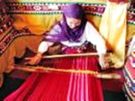
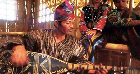
Mansaka Tribal Community
Situated in Maragusan, the tribal community is composed of the Mansakas whose culture is unadulterated by the outside world. Among the attractions of the place are the tribe’s authentic dances, native tribal jewelry complete with antique necklace, Mansaka musical instruments such as the “kudlong,” “paradag,” and “takol”, a native saxophone as well as their antique bells and gongs.

Magnaga Waters Beach Resort
One can not possibly miss the Magnaga Waters Beach Resort located in Pantukan because it is along the highway. It features a restaurant, several cottages, and a venue for meetings and conferences. Choose between a sleeping area at the Bungsod or a cottage by the sea.
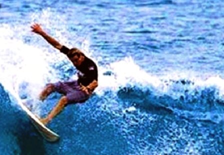
Kopiat Island
Located in Mabini, just off the coast of the municipality, Kopiat Island appears like a precious gem of exquisite beauty. It boasts of clear and calm waters ideal for a range of water sports activities. It has wide sections of shorelines blanketed with fine white sand. It has unspoiled reef areas with rare beds that serve as a sanctuary for exotic tropical fish and other aquatic resources.

Wednesday, September 27, 2006

Misamis Oriental

OVERVIEW
Nature tripping is a never-ending possibility in Misamis Oriental, one of the five provinces of Northern Mindanao.

From watersports and fine beaches to cave exploration and ethnic settlements, the list of nature-communing endeavors to be experienced in the province is longer than enough to fill a lifetime’s itinerary. Seas and beaches offer a limitless aqua adventure. Go scuba diving at Duka Bay and Mantangale, also a primary dolphin and whale shark watching destination. Find glorious hideaways in the white sand beaches of Midway Beach, Maputi White Beach, and Opol Beach Fronts. Go white water rafting and tubing in the rapids of Cagayan de Oro River, one of the longest rivers in Mindanao. Or simply get picture-happy at the San Isidro/Sagpolon, Palalan, and Tiklas waterfalls as well as Sapong Spring and the Cold Spring at Lagonglong.

A multitude of choices await the nature lover or adventurer. The Gardens of Malasag Eco-Tourism Village in Cagayan de Oro, a cultural village in a botanical setting, is home to Region 10’s tribal communities and endemic plants and trees. Also in Cagayan de Oro is Macahambus Cave, a historical site dating back to the 1900s. Initao Cave is home to the split-nose bat and the Initao National Park is a forest reserve with a natural limestone formation and marine life. Shift into a more relaxed pace at the Pueblo de Oro Golf and Country Club, situated along Lumbia Road in Cagayan de Oro. Or explore this city’s museums, from the Xavier University Museum showcasing Muslim-Bukidnon culture to the La Castilla Museum featuring household heirlooms.

GEOGRAPHY
Misamis Oriental is one of the five provinces of Northern Mindanao. Falling between 8°28'38"516 Latitude and 142°38'35"235 Longitude, the province is located along the northern coast of the island of Mindanao. It is bounded on the north by Macajalar Bay, on the west by Iligan Bay, on the south and southwest by the provinces of Bukidnon and Lanao del Norte, and on the east by Agusan del Norte.

POLITICAL SUBDIVISIONS
Misamis Oriental is one of the 22 provinces of Mindanao and one of the 4 provinces of the new Region 10. It has two cities, Cagayan de Oro, the capital, and Gingoog City, a component city, and 24 municipalities with 349 barangays.

POPULATION
Total population is 664,338 as of 2000.

LANGUAGE/DIALECT
Cebuano, Tagalog, Maranao, Hiligayon, Ilonggo, Waray, and English.

CLIMATE
Two types of climates in the province are based on rainfall distribution. The first type, which occurs in the eastern municipalities of Kinoguitan to Magsaysay, has a very pronounced maximum rainfall from November to January and generally wet the whole year. The second type, which occurs in the central and western part of the province, is relatively dry from November to April and wet during the rest of the year. It covers the municipalities of Sugbongcogon in the east and down to Lugait in the west. The climate is usually pleasant with warmer days and cooler nights.

INDUSTRIES
DEL MONTE PINEAPPLE CANNERY. Production area in Bugo, Cagayan de Oro City; processes juices and cocktails, among others.
MINDANAO PRODUCT SHOWROOM. Display area of all handicrafts in Region 10; managed by the Department of Trade and Industry in cooperation with the Cagayan Oro Chamber of Commerce.
OSTRICH AND CROCODILE FARM (Opol, Misamis Oriental). Owned by local Filipino-Chinese entrepreneurs and supplying the local markets and Manila.
MINDANAO SILK MULBERRY FARM (Claveria, Misamis Oriental). Houses the Philippine Textile Research Institute Mindanao Office.
PHIVIDEC INDUSTRIAL ESTATE (Tagoloan, Misamis Oriental). Home to several multinational corporations and big industries.
CERAMIC MAKING (Bulua, Cagayan de Oro). Items include jars, plates, and ornamental/gift items, among others. APTPCO (Gingoog City). Produces plywood.
INDO PHIL. OIL MILL (Medina, Misamis Oriental). Produces coconut oil.

PRODUCTS & INVESTMENT OPPORTUNITIES
A. Products

· Abaca-fiber-based
· Hand-made paper
· Silk cloth

B. Key players

· Handmade paper: 7 firms producing
· Silk: 4 major industry groups
· Handwoven abaca/other fiber: 4 firms and 3 weaver groups

C. Market

· Domestic: hand-made paper, fiber and finished products sold nationwide
· Exports: hand-made paper products shipped to Australia, Canada, Japan and United States

D. Trade and investment opportunities

· Product development clinics
· Strengthening of production capability
· Skills trainings

Tuesday, September 26, 2006

Bukidnon

OVERVIEW
Bukidnon is a highland paradise in the heart of Mindanao. It is home to the world's biggest pineapple plantation boasting a classic golf course dating back to 1928. It is the biggest cattle-producing province in the region.

It is well endowed with natural attractions like the Kitanglad Ranges that includes Dulang Dulang, the second highest peak in the country. And it has been identified as one of the country’s richest in biodiversity and endemic species of flora and fauna.Bukidnon is in the heartland of Mindanao, linking Davao to the south and Misamis Oriental to the north of the island.

LOCATION
Bukidnon is a landlocked province in northern Mindanao. It is bounded on the north by Misamis Oriental, on the east by Agusan del Sur and Davao, on the west by the Lanao provinces, and on the south by North Cotabato.

GEOGRAPHY
Bukidnon, a rich tableland, is a landlocked province in Northern Mindanao. It occupies the extensive plateau that is bounded on the north and the northeast by Misamis Oriental; on the east by Agusan; on the south and southeast by Davao; and on the southwest and west by Lanao and Cotabato. It lies between the parrallels 7'25' and 8'38' north latitude and meridians 124'16' east longtitude.Topography is predominantly a rolling tableland of grass with an average elevation of 915 meters. Low plains alternating with rolling uplands, deep canyons and valleys characterize the terrain.

POLITICAL SUBDIVISION
The province has a total of 464 barangays distributed among 21 municipalities and one component city. Malaybalay is the capital town. The province is grouped into 3 congressional districts.

LANGUAGE/DIALECT
The province has different dialects brought by the immigration of lowlanders that come from the different islands of the archipelago. Cebuano is spoken by 77.9% of the population; Binukid, by 8.9%; and English, by 0.05%.

CLIMATE
Bukidnon is relatively cool and moist throughout the year. There are two prevailing types of climate variations: the northern part has no pronounced maximum rain period, with a short dry season lasting only for one to three months, while the southern part has no pronounced maximum rain period and no dry season.

The province is outside the the typhoon belt. The mean annual temperature is 24.04°C with maximum and minimum temperature of 29.6°C and 18.5°C, respectively. The annual average rainfall is 2,581.84m.


PEOPLE
The province is an ethnic melting pot with Visayan, Tagalog, and Ilocano migrants. Despite a diversity of cultures, the people have adopted Cebuano as their language, supplemented by the native dialect called Binukid. The natives are mainly Bukidnons who occupy the lowlands of the plateau while the Manobos are in the highlands. Bukidnon settlements are clusters of households under their own datu. They engage. in kaingin farming, basket-weaving, and pottery.

The women wear colorful blouses cloth sewn together, and shawls embroidered in red. Some of the numerous indigenous tribes derive their name from their place of origin: the Tigwahanon after the Tigwa watershed , the Umayamnon after the Umayan River, the Pulangaiyon after the Pulangi River, and the Matigsalug after the Salug River. The Iliano and Langilaon were named after the borderareas they occupy. The tala-anding, named after a myth, are distinguished by the elaborate fan-like headgear their women wear during festivals.

PRODUCTS / INVESTMENT OPPORTUNITIES
Bukidnon is an agricultural economy. It is a major producer of rice, corn, sugar coffee, rubber, pineapple, tomato, flowers, cassava, and other fruits and vegetables. It is also a major producer of chicken, hogs, and cattle.Among its major corporations, Del Monte Phils Inc. is engaged in pineapple production and cattle fattening while Bukidnon Sugar Milling Corp. and Crystal Sugar Milling are into sugar milling and refining.

A. Products

· A sheltered environment for assembly, cooling, sorting, packing and storage of fresh vegetables, marketing and financing services

B. Key players

· Local government of Impasug-ong, Bukidnon (one of the investors)
· Department of Trade and Industry
· GEM
· Northern Mindanao Vegetable Producers Association
· Chamber of Agriculture, Fisheries and Food Industries in Northern Mindanao (CAFFINORMIN)

C. Market

· Domestic: nationwide

D. Trade and investment opportunities

· Packing shed with cold chain capability

Economy
Almost all large firms operating in the province are into production or processing of these agricultural products. Del Monte Philippines, Inc. (DMPI), Lapanday Diversified Products Corp. and Mt. Kitanglad Agri-Development Corp., Dole Philippines (Skyland), Bukidnon Sugar Milling Corporation (BUSCO), Crystal Sugar Milling, Phil-Agro Industrial Corporation, Menzi Agricultural Development, Agaropyta Phils. Inc., Bukidnon Greens Inc., FP Obrero Farms, ARDEM, Inc., San Miguel Foods Corp. (SMFI_PFC), Monterey Farms Corp. and Swift Foods, Inc.

As one of the major anchors in crop production, Bukidnon is moving forward towards establishing its position as a principal trader of rice, corn, sugar, potato, tomato and many other commercial and industrial crops.


Bukidnon’s fresh fruits and vegetables are either sold in domestic markets or exported to neighboring countries. Fresh pineapples, banana, sugarcane and cutflowers are among its exports.

History
Bukidnon became a part of Misamis in the latter part of 1850. The whole area was then called Malaybalay (few houses) and the people were known as Bukidnons (mountain people).

The Philippine Commission then headed by Commissioner Dean C. Worcester, Secretary of Interior and a member of the Philippine Commission proposed the separation of Bukidnon from Misamis Province.

On August 20, 1907, the Philippine Commission Act No. 1693 was enacted the Province of Agusan and sub- province of Bukidnon.

Bukidnon became a regular province on March 10, 1917 by virtue of the creation of the Department of Mindanao and Sulu under Act 2711.


Tourist Attractions

Natural
PAIYAK CAVE
Location: Palaopao Mountains of Sumilao, Bukidnon
This well preserved cliffside cave had created centuries old formatons as gleaned from undistributed stalactites and stalagmites.

NAPALIT CAVE
Location: 36 hectares lake, Pigtauranan, Pngantucan
It is at the foot of the Kalungtungan mountains. It stands out becuase of its twenty four (24) floating islets of varying size, the biggest of which in 50 -feet wide. These islets float around the lake parallel to the direction of the wind.


Man-Made
BUKIDNON SUGAR CENTRAL
Location: Quezon, Bukidnon
The Bukidnon Sugar Company (BUSCO) is the only sugar central in Northern Mindanao. This 40 million sugar mill has a processing capacity of4,000 to 6,000 tonsof cane daily.


DEL MONTE PHILIPPINES, INC.
Location: Manolo Fortrich, Libona, Impasugong and Sumilao.
Considered the biggest pineapple plantation in the Far East. It also has a famous world class 18 hole golf course located in Cawayanon, San Miguel.

Sunday, September 24, 2006

Zamboanga Sibugay

General Description
Owing to its natural land form, the province of Zamboanga Sibugay is blessed with an impressive range of excellent tourist destinations – interesting mountain formations, picture-perfect waterfalls, caves in which dwell thousands of bats as well as stalactites, hot springs, white sand beaches, and fish and sea snake sanctuaries.

Tantanan Bay is the largest fish sanctuary found in the province, encompassing an area of five hectares. Sibuguey Bay bounds the southern peripheries. Endowed with several coral formations that function naturally as fish sanctuaries, it is ideal for snorkeling and diving.

Another notable fish sanctuary, situated within the municipality of Talusan, is Takushari. Within the island of Pulo Laum is a sanctuary for the propagation of sea snakes.Zamboanga Sibugay is endowed with several islets that are ideal for beach resort development.

Notable are Pandilusan Island in the municipality of Payao and Litayon Island in the municipality of Alicia. One characteristic that they have in common is their white sand beaches. In addition to these islets, there are also white sand atolls in both municipalities that are submerged during high tides.

Leading the province’s inland tourist attractions are the large caves found in the municipalities of Tungawan and Talusan as well as the Moalboal Cave in the municipality of Titay. Among the majestic waterfalls are Tagbilat, Dalisay, Tugop Muslim, Cobacob, Go-otoc, Malagandis, Basay, and Palina Falls in Ipil.

Political Subdivision
There are 16 municipalities comprising the province: Tungawan, R.T. Lim, Ipil, Titay, Naga, Siay, Kabasalan, Imelda, Diplahan, Buug, Malangas, Alicia, Payao, Mabuhay, Talusan and Olutanga. It has a total of 389 barangays under one Congressional District.

Geography
Zamboanga Sibugay has an approximate total land area of 322,830 hectares accounting for about 37.82 percent of the mother province of Zamboanga del Sur. It is geographically located at 123o 04’ 49.75” longitude and at 7o 42’ 14.89” latitude. To the north it intersects the common municipal boundaries of Kadawit, Tampilisan, and Godad in Zamboanga del Norte.

In the west, it is bounded by the municipalities of Siraway, Siocon, and Balinguian, and the province of Zamboanga del Norte. On the south it is bounded by Sibuguey Bay. In the east, the municipalities of Bayog and Kumalarang both in the province of Zamboanga del Sur bound it. It is further bounded on the southwest by Zamboanga City.

Climate
The climatic condition of the province is moderately normal (climate type III). Annual rainfall varies from 1,599 mm to 3,500 mm. Temperature is relatively warm and constant throughout the year ranging from 22o C to 35o C. The province is situated outside the typhoon belt.

Industries
The leading industries are in the areas of bakery, rice and corn milling, food processing, and rattan and wood furniture production. The new players in the field are concrete products, garments, wax and candle factory, and other cottage industries.Major crops produced include rice, corn, coconuts, rubber, fruit trees, vegetables, tobacco, coffee, cacao, and root crops. Livestock and poultry productions are predominantly small-scale backyard operations.

Population
The 2000 census reported a total population of 49,239 with an annual growth rate at 2.09%.

Dialects
The major dialects are Cebuano and Ilonggo. Tagalog, Ilocano, and other ethnic tongues are spoken as well.


Products / Investment Potentials

A. Products
· Product quality and productivity improvements for small rubber farmers in the province

B. Key players
· 2 rubber processors/exporters

C. Market
· Domestic
· Export: United States and Malaysia

D. Trade and investment opportunities
· Creation of Zamboanga Sibugay as a new province where the rubber industry is situated. A closer attention among provincial executives and legislative bodies for development is more focused.
· Ongoing concretizing of the national highways that cut across the major rubber plantation areas to eventually reduce the cost of transportation.

Monday, September 04, 2006

Davao City

Davao City is in Southern Mindanao region of the Philippines.

Considered as one of the fastest growing regions in the country, it consists of the provinces of Davao, Davao Sur, Davao Oriental, Surigao del Sur and South Cotabato an the cities of Davao and General Santos.

Davao is located in the southeastern corner of the island of Mindanao, in a region that also comprises the provinces of Davao, Davao del Sur, Davao Oriental, South Cotabato, Sarangani and General Santos City.

A well-endowed land, the province is bordered by swamps, jungles, sandy beaches, and high mountain ranges, most significant of which is Mount Apo, the country's highest peak at 10,311 feet above sea level.

The city sits at the mouth of Davao Gulf, in the northeastern part of Davao Province.

A total land area of 244,000 hectares makes it the world's second most extensive city and the country's fastest growing trade center for East ASEAN Growth Area (EAGA), an economic trade union participated in by Brunei, Indonesia and Malaysia.

Its mild, pleasant climate with evenly distributed rainfall and low incidence of typhoons is ideal for agriculture.

In the south of the city, one can find the biggest tracts of arable lands where huge fruit plantations and ornamental flower gardens are located. Aside from bananas and pomelos (a kind of local grapefruit), other plantation products include abaca, ramie, corn, rice, coffee and coconuts. Its orchid gardens yield a wide variety of rare and endemic species such as the waling-waling (Vanda Sanderiana).

Davao City is considered the world's largest city in terms of land area which is 2,443.6 square kilometers. It has an estimated population of 1,006,84 accounting to 19% of the entire Southern Mindanao region. It is the second biggest urabn market within the East ASEAN Growth Polygon.

Davao continues to be the top exporter of Region XI exporting to major world markets such as Japan, the United States of America, the Middle East, and Europe.

The city is fast industrializing. Recent trends show that is economy is steadily moving away from agriculture towards value added processing activities

History

Local historians claim that the word davao came from the phonetic blending of the word of three Bagobo subgroups when referring to Davao River, an essential waterway which empties itself into Davao Gulf near the city.

The aboriginal Obos who inhabit the hinterlands of the region called the river, Davoh; the Clatta or Guiangans called it Duhwow, or Davau, and the Tagabawa Bagobos, Dabu.

To the Obos, the word davoh also means a place "beyond the high grounds", alluding to the settlements located at the mouth of Davao River which were surrounded by high rolling hills.

When asked where they were going, the usual reply is davoh, while pointing towards the direction of the town. Duhwow also refers to a trading settlement where they barter their forest goods in exchange for salt or other commodities.

Spanish influence was hardly felt in the Davao until 1847, when an expedition led by Don Jose Oyanguren came to establish a Christian settlement in an area of mangrove swamps that is now Bolton Riverside.

Davao was then ruled by a Moro chieftain, Datu Bago, who held his settlement at the banks of Davao River (once called Tagloc River by the Bagobos).

After Oyanguren defeated Datu Bago, he renamed the region Nueva Guipozcoa, in honor of his home in Spain, and became its first governor. Oyanguren's efforts to develop the area, however, did not prosper.

A few years after the American forces landed in 1900, private farm ownership grew and transportation and communication facilities were improved, thus paving the way for the region's economic growth.

A Japanese entrepreneur named Kichisaburo Ohta was granted permission to exploit vast territories which he transformed into abaca and coconut plantations.

The first wave of Japanese plantation workers came onto its shores in 1903, creating a Japan kuo, or Little Japan. They had their own school, newspapers, an embassy, and even a Shinto Shrine.

On the whole, they established extensive abaca plantations around the shores of Davao Gulf and developed large-scale commercial interests such as copra, timber, fishing and import-export trading.

Filipinos learned the techniques of improved cultivation from the Japanese so that ultimately, agriculture became the lifeblood of the province's economic prosperity.

Davao was formally inaugurated as a charter city in March 16, 1937 by President Elpidio Quirino.

Thirty years later, Davao was subdivided into three independent provinces, namely Davao del Norte, Davao del Sur, and Davao Oriental.

Over the years, Davao has become an ethnic melting pot as it continues to draw migrants from all over the country, lured by the prospects of striking it rich in the country's third largest city. (clickdavao)